Randonnée Marche Le Mesnil-Aubert - La Rue Cavée - Le Mesnil Aubert  - Photo

La Rue Cavée - Le Mesnil Aubert

 tracegps
tracegps

Utilisateur

© OpenStreetMap contributors
Longueur
Longueur
10,1 km
Altitude max
Altitude max
94 m
Dénivelé positif
Dénivelé positif
119 m
Km-Effort
Km-Effort  
11,7 km
Altitude min
Altitude min
26 m
Dénivelé négatif
Dénivelé négatif
119 m
Boucle
Boucle
Oui
Date de création :
2014-12-10 00:00:00.0
Dernière modification :
2014-12-10 00:00:00.0

(0 Avis)

Marche
Marche
2h00
Difficulté : Moyen

Scannez ce code QR pour ouvrir la randonnée dans l'application SityTrail

Application GPS de randonnée GRATUITE

Logo SityTrail SityTrail

IGN / Instituts géographiques

Télécharger SityTrail sur l'App Store Télécharger SityTrail sur Google Play

Logo SityTrail SityTrail World

Le monde est à vous

Télécharger SityTrail sur l'App Store Télécharger SityTrail sur Google Play Télécharger SityTrail sur Huawei AppGallery

À propos

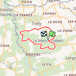
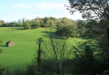
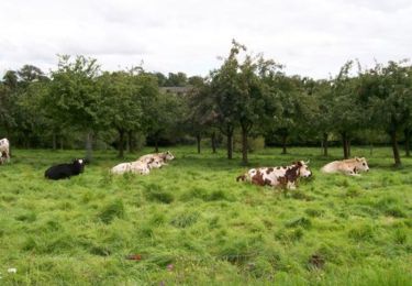
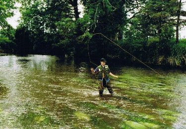
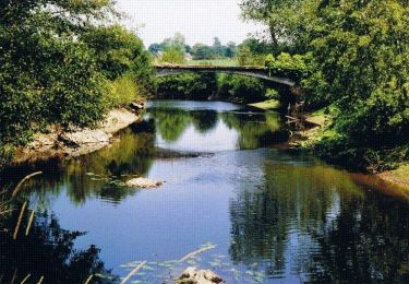
Randonnée Marche de 10,1 km à découvrir à Normandie, Manche, Le Mesnil-Aubert. Cette randonnée est proposée par tracegps.

Description

Départ de la place de la mairie du Mesnil Aubert

Profil altimétrique

Photos

Localisation

Pays :
France
Région :
Normandie
Département/Province :
Manche
Commune :
Le Mesnil-Aubert
Localité :
Unknown
Départ:(Dec)
Départ:(UTM)
616131 ; 5422702 (30U) N.

Randonnées à proximité

Randonnée Marche Gavray-sur-Sienne - Gavray - Circuit long - Photo
Marche
lionelnottat

Marche

Très difficile
(2)
Gavray-sur-Sienne, Normandie, Manche, France
16,6 km | 21 km-effort
4h 31min
Oui
Randonnée V.T.T. Gavray-sur-Sienne - gavray - Photo
V.T.T.
dumbell

V.T.T.

Très facile
Gavray-sur-Sienne, Normandie, Manche, France
24 km | 29 km-effort
2h 31min
Oui
Randonnée Marche Cérences - Le Moulin de Guelle - Cérences  - Photo
Marche
tracegps

Marche

Moyen
Cérences, Normandie, Manche, France
12,6 km | 15,8 km-effort
3h 0min
Oui
Randonnée V.T.T. Gavray-sur-Sienne - Randonnée autour de Gavray - Photo
V.T.T.
tracegps

V.T.T.

Difficile
Gavray-sur-Sienne, Normandie, Manche, France
31 km | 39 km-effort
2h 45min
Non
Randonnée V.T.T. Cérences - VTT de Cérences à Beauchamps - Photo
V.T.T.
tracegps

V.T.T.

Très difficile
Cérences, Normandie, Manche, France
52 km | 65 km-effort
4h 0min
Oui
Randonnée Marche Cérences - La Voie Romaine - Cérences  - Photo
Marche
tracegps

Marche

Moyen
Cérences, Normandie, Manche, France
6,6 km | 7,7 km-effort
1h 30min
Oui
Randonnée Marche Cérences - Entre Batterel et Sienne - Cérences  - Photo
Marche
tracegps

Marche

Moyen
Cérences, Normandie, Manche, France
11,7 km | 14 km-effort
2h 19min
Oui
Randonnée Marche Cérences - Les Vallons de Cérences  - Photo
Marche
tracegps

Marche

Moyen
Cérences, Normandie, Manche, France
19,3 km | 23 km-effort
4h 15min
Oui
Randonnée Marche Cérences - Les Bois - Cérences - Photo
Marche
tracegps

Marche

Moyen
Cérences, Normandie, Manche, France
7,3 km | 9,4 km-effort
2h 0min
Oui


Fermer
Mes abonnements